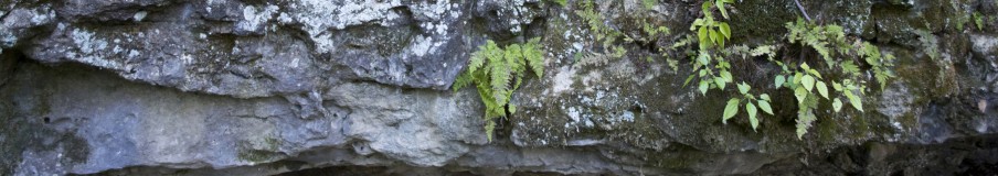


East Channel, Upper Mississippi, Prairie du Chien, Wisconsin
On Monday, Secretary of the Interior Ken Salazar announced the approval of the Upper Mississippi between Rock Island, Illinois and Wabasha, Minnesota as a Wetland of International Importance. The 300,000 acres covered include the Upper Mississippi National Wildlife and Fish Refuge, the Trempealeau National Wildlife Refuge.
Between the bluffs the Upper Mississippi is a mosaic of marshes, wooded islands, and backwaters. The river is the wetland.

Trempeauleau Bay, Trempealeau NWR
Even though the Upper Mississippi refuge receives more visitors than Yellowstone Park, it surprises me how few people realize what a treasure it is. The Grand Canyon is magnificent; the Upper Mississippi River canyon is green and accessible. But the river is in trouble and so is the refuge. An example is Weaver Bottoms in Wabasha County, Minnesota.

Weaver Bottoms: Half Moon Lake
Before the construction of Lock and Dam 5 to the south, Weaver Bottoms was a hay meadow, growing on a piece of Kingston terrace. It was protected from flooding by the high natural levee of the Mississippi. Construction of the dam flooded it, turning it into a productive wetland filled with American lotus. Its function as a wetland has been deteriorating ever since.
In the 1960s vegetation began to disappear. Phragmites, a tall cane that protected Weaver Bottoms, dried out and died, leaving the marshland unprotected from wind. Each time floodwater overtopped the remnant of the natural levee, the river deposited sterile sand into the wetland, leaving its shallow waters vulnerable to wind fetch–wind blowing steadily in the same direction–which stirred the sand, muddied the water, and made it impossible for aquatic plants to take root. The population of smooth soft-shelled turtles, which feed by sight on small fish in Weaver Bottoms, declined.
In 1986 the Corps of Engineers built two free-form islands in Weaver Bottoms in an attempt to cut down on wind fetch and restore aquatic vegetation, only to realize ten years later that the project had increased erosion in the bottoms.
Finally, the Whitewater River flows into Weaver Bottoms. The Whitewater rises in uplands dominated by row crops and washes a blanket of silt into the southern reaches of Weaver Bottoms, muddying the waters and smothering beds of wild celery and pondweed, which anchor the bottom. Should this process continue the Whitewater will return prime Weaver Bottoms marsh into dry land at the rate of two acres a year.
In 1996 Congress authorized the Small Watershed Program to provide technical and financial assistance to state and local governments to protect and restore watersheds damaged by erosion, flooding, and runoff. In the Spring of 1997 folks who live in the Whitewater watershed, along with the Minnesota Department of Natural Resources and the U.S. Fish and Wildlife Service, developed a plan for restoring Whitewater watershed. They applied for funds to carry out their plan the following February. The watershed program provides money that enabled farmers to adopt river-friendly practices in the way they manage their farms: contour plowing, using chisel plows instead of moldboard plows to slow erosion; building livestock waste settling basins; establishing buffer strips along streambanks and vegetating them in native warm-season grasses that survive the Minnesota winters; erecting low-cost electric fences along the buffers to keep cows from trampling the grasses that hold the soil along streambanks.[i]
[i] Conversation with Mike Davis, Minnesota NDR, Lake City, Minnesota, October 1996; Upper Midwest Environmental Science Center, “Whitewater River Habitat Rehabilitation and Enhancement Project,” http://www.umesc.usgs.gov/httpp_data/hrep_projects/whitewater_river.html, January 13, 2001, Minnesota Department of Natural Resources, “Mississippi Yields Record Turtle, September-October 2002, http://www.dnr.state.mn.us/volunteer/sepoct02/turtles.html, November 26, 2002; Schmitz, Rod, “Saving Turtles to Save the Mississippi,” Minnesota Public Radio, October 25, 2001, http://news.mpr.org/features/200110/25_schmitzr_turtles-m/index.shtml, November 26, 2002; Minnesota Department of Natural Resources, Fish and Wildlife Today, “ Whitetails Weather Winter’s Worst, “ Spring 1997, http://www.dnr.state.mn.us/fwt/back_issues/march97/whitval.html, November 26, 2002; Watershed Plan-Environmental Assessment, Phase II-Grant Application, Whitewater Watershed, Minnesota, Olmsted, Wabasha, and Winona Counties, February 1998, http://www.mn.nrcs.usda.gov/watersheds/ whitewater/abstract.pdf.
Filed under: Ecosystem, Fine Art Photography, Mississippi River, Photography, Upper Mississippi, Wetlands | Tagged: Nine-Foot Navigation Channel, Prairie du Chien, Trempealeau NWR, Weaver Bottoms |

Leave a comment