

When Gen Edgar Jadwin decided to send floodwater down the Atchafalaya, he was restoring it to its natural function as a distributary of the Mississippi, a river that carries water away from the big river. Gen. Harley Ferguson described the Atchafalaya’s traditional role before we constructed levees that sent water that might have drained to the Gulf of Mexico by other routes into the Mississippi.
So now that the Morganza structure is partially opened and working to reduce flood levels at Baton Rouge and New Orleans, what exactly is in the Achafalaya Floodway and how does the Corps of Engineers manage it.
From The Mississippi: “In the wake of the Flood of 1927 General Edgar Jadwin left the left the head Atchafalaya open as the only distributary carrying water from the main channel of the Mississippi. He turned the river and its swamps into a floodway, 1,400,000 acres of farmland and river swamp broken into three parts, hemmed between levees set seventeen miles apart. The Morganza and West Atchafalaya Floodways occupy pastureland and soybean fields separated by bayous lined with oak, pecan, and sweet gum. They feed into the Atchafalaya Basin Floodway, the largest river swamp in the world, freshwater lakes where clumps of young tupelo and cypress stand among the rotted stumps of trees that were logged and dragged out of the swamp after the Civil War. Bayous lined with willows weave in and out of the lakes.”

Oil Platform and field near Swayze
The upper third of the Atchafalaya Basin looks very much like the farm fields found in Mississippi, Arkansas, and northern Louisiana. In addition the whole basin hosts 2,264 oil or natural gas wells, which produce 19,278 barrels of crude oil per day and 252.6 million cubic feet of gas per day. Finally, a refinery at Krotz Springs produces 83,000 barrels per day. A ring levee surrounds Krotz Springs and a temporary levee is being constructed around the refinery now that the Morganza structure is open.

Sherburne Wildlife Management Area
South of Krotz Springs, the Lower Atchafalaya Floodway covers 595,000 acres. The state of Louisiana owns 192,000 acres, including 27,000 acres purchased for the Sherburne Wildlife Management Area, opened in 1984, and and additional 30,000 acres donated by Dow Chemical. Congress authorized the 15,000- acre Atchafalaya National Wildlife Refuge a year later. In 1994 the Corps of Engineers purchased 50,000 acres for fish, wildlife, and recreation, including 16,000 acres adjacent to the two refuges.

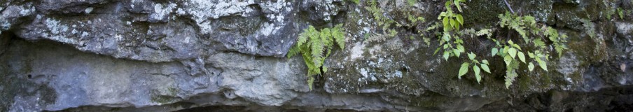
Atchafalaya National Wildlife Refuge at the end of the East Atchafalaya River Levee
The Corps of Engineers purchased flowage eastments on the remaining 338,000 acres, much as it did in the New Madrid Floodway, which gave it the right to flood the land when it needed to open either the gates of the either the Morganza Floodway or the West Atchafalaya floodway. The state threw in the flowage rights on its 192,000 acres, and the U.S. Fish and Wildlife Service on its 15,000 acres. These are the lands that will be flooded below Krotz Springs. The Corps maintained the right to prevent the construction of permanent buildings and to require permits for any temporary structures in the lower floodway.

Opelousas Bay, Henderson
Finally, the Corps also had the right to prohibit the development of the land for new purposes and the right to nix certain logging practices without a permit. In short the Corps of Engineers controls the Lower Atchafalaya Floodway, where its primary authority is flood control. Fish and wildlife and recreation are secondary. Hence, environmentalists from the Sierra Club, Audubon, Duck Unlimited, and others keep a watchful eye on the health of the wetlands in the floodway and raise hell if they don’t like corps’ decisions on management.
Filed under: Atchafalaya River, U.S. Army Corps of Engineers | Tagged: Atchafalaya National Wildlife Refuge, Sherburne WMA |

Excellent post Quinta. You are a one-stop shop for all things La. wetland related!! I’m so glad I know where to find you! Part of me can’t help but think that your knowledge, photos, and the connections several of us have made over the past few years must have a bigger meaning. Do you have an idea yet what that is?
Louisiana’s coastal plain fascinates me. It is all inter-related and all connected to or disconnected from the Mississippi River, clear north to St. Paul and to the Missouri, clear up river to the first of the dams. The purpose of *The Mississippi: A Visual Biography* is to help people understand that. It starts with how the river was formed, how we have disrupted its natural processes, and how we are learning to manage the river we have created. That is what you and I are working on. You are highlighting life in the wetlands. My work is more academic and detached, because I don’t live along your bayou. I live in the uplands overlooking the floodplain.