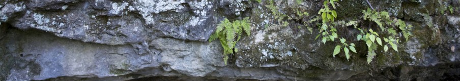
• The Mississippi: A Visual Biography by Quinta Scott

    "Great book and great blog - thanks for the first book I have seen that addresses the contemporary river, headwaters to gulf." Dan McGuiness, Audubon, St. Paul, Minnesota

    Click to order

  • Catagories

  • Archives

  • May 2024
    M T W T F S S
     12345
    6789101112
    13141516171819
    20212223242526
    2728293031  
  • Meta

The Flood of 2011 and the Atchafalaya Delta

“Artificial levees, extending clear to the Gulf of Mexico, may have made human habitation of the delta south of Cape Girardeau possible, but prevented the Mississippi from refreshing its marshes with its sediment when it did flood. Revetments built of concrete mats may have stabilized the navigation channel, but reduced erosion of the banks, a source of sediment in the marshes. James Eads’ jetties at the mouth of the river may have allowed the river to cut a thirty-foot navigation channel through the sandbar blocking the South Pass of the modern delta, but delivered sediment carried by the river to very deep water at the continental shelf, where it washed away, never to be used for marsh building. Closure of the old distributaries of the river may have prevented flooding in the bayou country of Louisiana, but cut the flow of Mississippi sediment to the coastal marshes. Channel dams may have made navigation on the Upper Mississippi profitable, but they retained its sediment north of Alton, Illinois. Dams on the Missouri, from which the Mississippi drew sixty percent of its sediment, did the same. In short at the beginning of the twenty-first century, the coastal marshes south of New Orleans received eighty percent less sediment than they had at the beginning of the twentieth and eroded away.”

I haven’t counted the number of posts I have begun with this quote from The Mississippiand I am doing so again.

Morganza Floodway Structure

Twice, 1973 and 2011, since it was constructed after the Flood of 1927, we have opened the Morganza Floodway Structure to release flood water from the Mississippi into the Atchafalaya River and Floodway. After the Flood of 1973, geologists noted that the Atchafalaya River was building land at its mouth, using all that mud funneled down the Mississippi from erosion from the Midwest and the South.

With this in mind geologists from the University of Pennsylvania–joined by others from the University of Mississippi, Louisiana State University, and the U.S. Geological Survey–began studying the sediment plumes that spewed out of the Mississippi, the Atchafalaya River and Wax Lake Outlet, and through the Bonnet Carre Spillway into Lake Pontchartrain during the Flood of 2011.

Sediment Plumes from the Atchafalaya, Mississippi, and Bonnet Carre

Atchafalaya Delta, 2009

The Atchafalaya slowly spread a wide plume of sediment in to Atchafalaya Bay, where it is building land. The Mississippi, which is too long and too flat and is hemmed between levees, is shooting its mud over the edge of the continental shelf, where it is useless for landbuilding.

Wax Lake Outlet Delta

Similarly, the Wax Lake Outlet, an artificial outlet from the Atchafalaya Basin, built to reduce flooding in the basin, is building its delta.

What is happening in Atchafalaya Bay is what happened naturally before we reengineered the Mississippi for flood control and navigation. Now that we have done it, we have to live with the consequences and find ways to restore Louisiana’s coastal wetlands by mimicking the river’s ways. The Atchafalaya is an example. So is the Mardi Gras diversion at Bohemia, which opened up into Breton Sound this spring during Mardi Gras.

The Mississippi Ridge at Bohemia south of the end of the main line levee

The question about the Mardi Gras Diversion is whether we are going to keep it or dam it. It is an example of what is being done on a small scale and can be done on a large scale along the Mississippi south of New Orleans.

Demands on the Atchafalaya River: Rice Farming in the Mermentau Basin of Southwestern Louisiana

Grand Prairie Rice Field, Arkansas

Rice farmers needing water: they need it on Grand Prairie in Arkansas where they are depleting the great Mississippi Aquifer; they need it in Southwestern Louisiana where numerous alterations to the landscape has changed the way freshwater flows through the Mermentau and Calcasieu Basins west of Vermillion Bay.

For the long story about rice farming On Grand Prairie in Arkansas, read The Mississippi. Essentially, rice farmers on Grand Prairie want to tap the White River, which runs along the eastern edge of Grand Prairie, and pump the water through a series of canals and into their rice fields. The pump is under construction at Du Vall’s Bluff along the White River, which could change the way water flows through the White River National Wildlife Refuge.

And like rice farmers on Grand Prairie who want to tap the White River for water for their fields, rice farmers in the Mermentau Basin want to tap the Atchafalaya River, some sixty miles or more away, depending on where you tap the Atchafalaya. It will require a series of pumps and canals to accomplish the task.

Last summer as the Mississippi and Atchafalaya carried the Flood of 2011 to the Gulf of Mexico, the rice farmers in the Mermentau Basin watched in frustration as their rice fields dried up in the Drought of 2011 and salt water intruded into them from the Gulf. Some farmers never even planted a crop.  And because they double crop and breed crawfish in their rice ponds, that source of income was also compromised.

The Mermantau and Calcasieu Basins form the Chenier Plain, which William Darby described to a “T” in 1818:

“The marsh between Vermilion bay and the Lake of Mermentau, has nothing to distinguish it from the other marshes of the country, except in its extent, which is about thirty miles square. This great expanse, though generally covered with grass, is not entirely denuded of trees. Near the sea-coast, a singular appearance attracts the attention. These are ridges, which rise above the common level of the marsh, are dry and solid land, clothed with live oak trees. These ridges appear to have once been the sea-shore, and to have been in succession abandoned by the surf, as others were formed by the same means; they all run in lines parallel to the shore, and are separated by lagoons, ponds or the marsh. It is extremely difficult to reach many of these islands; and as no adequate object presents itself to reward the trouble, they are visited but seldom by man. They are the undisturbed retreat of wild animals, deer, turkies, grouse, and perhaps the bear.”–William Darby, 1818

Sediment, pouring out of the Mississippi and flowing westward on longshore currents, came to rest in the successive ridges that form southern reaches of the Chenier Plain. We have disrupted that process of land building with the changes we have made to the Mississippi. There is less sediment spewing out of the river. What does flow out of the river is deposited in very deep water at the continental shelf, where it is unavailable for land building. We have disrupted the long shore currents with jetties. However, some sediment is flowing out of the Atchafalaya and being deposited on the eastern edge of the Chenier Plain, but not enough.

The Mermentau Basin breaks down into two parts: the northern wet prairie, where rice is grown, and the southern Chenier Plain, where ridges and wetlands alternate across the landscape.


Like Grand Prairie the northern reaches of the Mermentau Basin are wet prairie, where the low grade and heavy clay soil are ideal for rice farming, because clay prevents the water in rice fields from seeping into the aquifer below. And like Grand Prairie farmers have tapped the bayous that flow through the region and constructed a system of canals to deliver water to their rice fields. In doing so they have changed the way water flows through the region. 

The Corps of Engineers constructed a series of locks and water control structures on Grand and White Lakes to control water levels, convert them into freshwater reservoirs for rice irrigation, and prevent the intrusion of saltwater into the lakes. Continuing high water levels in the Lakes sub-basin drowned wetlands and shifted in the composition of plants. Where excessive flooding eroded the rims of Grand Lake and White Lake, the marshes behind and below the rims also eroded. Saltwater intruding along navigation canals killed freshwater plants, baring the soil that supported them. Tides washed the soil away, converting marshlands to open water.[i]

Then there is what we have done to the Chenier Plain itself: The construction of Louisiana Highway 82 in 1958 across the top of Pecan Island, through the marshes, and across the top of Grand Chenier Ridge, all in the southern reaches, stopped the natural flow of water from north to south. The system of thirty-two culverts and a dozen bridges, designed to allow drainage through the highway, never adequately replaced the natural drainage in the basin. By the turn of the twenty-first century most of the culverts had silted in or collapsed, turning Highway 82 into a dam across the basin, leaving the Lakes sub-basin to the north subject to constant flooding and the Chenier sub-basin to the south starved for freshwater.

The dredging of the Freshwater Bayou Channel, the Mermentau River-Gulf of Mexico Navigation Channel, and dozens of oil access channels allowed saltwater into the Chenier sub-basin marshes, which disintegrated. The introduction of suspended sediment into the western part of the sub-basin restored some of the marshes, but they were disappearing from the rest of the basin.[ii]

The Atchafalaya River is a distributary of the Mississippi. It carries 30% of the Mississippi all of the Red River to the Gulf of Mexico. It is the Mississippi “wannabe,” and Congress and the Corps of Engineers have worked hard to keep the Atchafalaya from capturing the full flow of the Mississippi. Louisiana’s coastal scientists are looking at the Atchafalaya as a source of fresh water for the declining coastal marches, particularly those in the western Terrebonne basin, where salt water is intruding into freshwater marshes. Already, Atchafalaya water is being directed into the Vermillion Basin, just to the east of the Mermantau Basin. A year ago Mermentau rice farmers watched their rice fields dry up as the Flood of 2011 drained away into the Gulf of Mexico, where it was useless for rice farming. Some of that precious freshwater did make its way into the western Terrebonne marshes, where, for the summer of 2011, it pushed salt water out of the marshes.


[i]             Clark, Darryl, and Mazourek, Joyce, Final Environmental Assessment, Freshwater Introduction south of LA Highway 82 Project (ME-16), Lafayette, Louisiana: U.S. Fish and Wildlife Service,  Marsh 2005, 1, http://lacoast.gov/reports/env/Hwy%2082%20ME-16.pdf.

[ii]             Louisiana Department of Natural Resources, Hydrologic Investigation of the Louisiana Chenier Plain, Prepared for the Louisiana Coastal Wetlands Conservation and Restoration Task Force, October 2002, 15, http://www.lacoast.gov/reports/static/HILCP_2.pdf;

The Corps is closing some of the Morganza Bays: Where didn’t the water go?n Where could it go if the Atchafalaya were managed differently?

Floodwater from the Atchafalaya Floodway spreading east and west through the Coastal Marshes

A week ago I wrote about the interplay between the Lower Atchafalaya River and the GIWW, the Intracoastal Waterway. I included an image of the backwater flooding that could occur throughout the coastal wetlands. It was one of several the Corps issued when it opened the Morganza on May 14. structure. The Daily Comet in Lafourche Parish has an article about where the water didn’t go. The worry over flooding in the Atchafalaya Basin isn’t over, but it is easing.

A key phrase in the article: “backwater flooding from a complex network of bayous, lakes and canals was not materializing.” And the sinking of a barge in Bayou Chene prevented flooding in Terrebonne Parish.

Bayou Chene at Avoca Island

When the Mississippi and Atchafalaya are not in flood, fresh water is funneled into the western Terrebonne marshes in a most indirect way:  When the Atchafalaya runs 3 to 4 feet about flood stage, water works its way around Avoca Island through the Avoca Island Cutoff to Bayou Chene and into Bayou Penchant and the fresh marches of the western Terrebonne basin.

Crab Boat on Bayou Penchant

The delta that is forming at the mouth of the Atchafalaya River and the Wax Lake Outlet broke the surface of Atchafalaya Bay in 1973. Only 10% of the sediment in the Atchafalaya River is actually used to build land at its mouth. The rest is wasted in the Gulf of Mexico, much like the sediment shooting out of the mouth of the Mississippi.

The Kemp/Hyfield proposal to divert water and sediment from the Atchfalaya to the Penchant Marshes. From the Multiple Lines of Defense Proposal

In 2006 Paul Kemp and Emily Hyfield (see page 11 in Multiple Lines of Defense Proposal) proposed redirecting all that freshwater and sediment into the western Terrebonne marshes by breaking through the East Protection Levee of the Atchafalaya Floodway and running a spillway through Lake Palourde north of Morgan City and into the Penchant Basin. Doing so would strengthen the Penchant Landbridge of freshwater marshes and flotant. The spillway would be designed to operate at 140,000 cubic feet per second, but would normally operate at 20,000 cubic feet per second and would take some of the pressure off Morgan City when the Atchafalaya is flooding.

An alternative would be to short cut what is already happening and run a spillway across Avoca Island to Bayou Penchant.

The Magic of the Atchafalaya River Swamp

Six Mile Lake

In 1812 President Thomas Jefferson sent Captain Amos Stoddard to explore the Louisiana coastal plain, including the Atchafalaya Basin. He was one of the first to describe the strings of lakes and bayous that laced together the Atchafalaya Swamp, which divided the “Delta from what is called the elevated country.”

The Lower Atchafalaya Basin

From thirty miles below Old River, “the Chafalia affords a beautiful sheet of water, at least as far down as Cow island, from seventy-five, to one hundred and fifty yards wide, and from twenty-five to thirty feet deep in the dry seasons. At Cow island the stream is divided; one part spreads into a large lake; the other part continues its course, and seems to maintain its usual breadth and depth. The current of the Chafalia is gentle till it is joined by the Plaquamines about one hundred fifty miles from the outlet on the Mississippi, which its velocity is considerably increased. It communicates with lake Natchez by means of several bayous, the largest of which is bayou Long. This bayou is connected with lake Flat, Grand river, and Grand lake, by means of several bayous, most of which are navigable in the season of high water. Grand lake is about forty miles long, and from three to ten miles wide, into which the Chafalia is emptied by a channel of about two hundred fifty yards wide; and a depth of nearly forty feet. It then posses through Berwick bay, which is from half a mile to two miles wide, and from sixty to eighty feet deep; and after a course of about twelve miles, it falls into Vermillion bay, which is an arm of the gulf.”–Captain Amos Stoddard

In 1982 the Corps of Engineers issued its Final Environmental Supplement, its plan for the Atchafalaya Basin. This came only after a multi-year battle with those people who cherish the Atchafalaya River Swamp and did not want to see it stripped of its trees, drained, and turned over to agriculture. The plan forbad the conversion of the swamp to other uses, including agriculture, and it banned certain logging practices.

Another source of concern for the Atchafalaya environmentalists was the huge amount of sediment being deposited in the lakes that compose the river swamp. The process began as the Atchafalaya drew more and more water and sediment from the Mississippi and from the Red River. Until 1917 the lower two-thirds of the Atchafalaya Basin was an open freshwater lake. Between 1917 and 1930 the Atchafalaya deposited 4.63 square miles of sediment into Grand Lake at its head and continued to do so at the rate of three-fourths of a square mile per year. By 1989 the process of sedimentation reduced the great basin lake, which once covered 230 square miles, to series of small shallow lakes—Six Mile Lake, Upper Grand Lake, Lower Grand Lake, and others—which cover fifty square miles at the basin of the basin north of Morgan City.

Which brings us to the Flood of 2011. Yesterday, the U.S. Geological Survey issued a press release noting that this flood increase the rate of sedimentation in the swamp. It will erode some parts of the basin just below the Morganza Spillway and deposit sediment in cypress-tupelo swamps that are normally isolated from the process of sedimentation.

Sherburne Wildlife Management Area: Des Ourses Swamp

Willows, the pioneers species on new soil, took root on the edge of Des Ourses Swamp, one of the many lakes in the Atchafalaya river swamp. The wetland and its surrounding forest swamp are a birding paradise. Ducks–mallards, woodies, gadwalls, shovelers, pintails, wigeons, teals, mergansers, and ring-neckeds–spend the winter. Wading birds–stilts, yellowlegs, sandpipers, dowitchers–stalk the shallows. Plovers, killdeers, sandpipers, and snipes pick their way through the mud flats in July when the impoundment is drained. American woodcocks fly in at dawn and dusk. Kites–swallow-tailed and Mississippi, red-shouldered-hawks, barred owls, woodpeckers–downy and red-bellied loggerhead shrikes, Carolina wrens, gnatchatchers, warblers, and oriole inhabit the forest, joined in the winter by kestrels, kingfishers, phoebes, kinglets, thrushes, robins, sparrows–field, song, white-throated, and white-crowned, and warblers–orange-crowned and yellow-rumped.[i]

Bayou to Upper Grand Flat

The banks of a narrow slough between Upper Grand River and Upper Flat Lake are lined with willows and carpeted with cockleburs. Depending on the water level, sometimes the slough flows to the lake and sometimes it flows to the river. Sometimes, it is flooded, and sometimes no more than a muddy ditch, too thick to paddle a canoe in and too wet to walk in.

Within the Lower Atchafalaya Floodway there were 94,000 acres of pioneer forests on recently deposited sands when the 1982 plan was issued. Nearly pure stands of willow could be found on new deposits. Older deposits hosted a mix of willow, cottonwood, and sycamore, with waxmyrtle, false nettle, lizard’s tail, blackberry, shield fern, and swartweed growing in the understory or covering the ground. The willow forests provided habitat for deer, swamp rabbits, and migratory songbirds.

As more and more sediment accumulated and the land dried out, the pioneer forests would evolve into productive bottomland hardwood forests, treed in oaks–water, willow, Nuttal, and overcup; pecans, ash, and red maples: habitat for wildlife, gold to the timber industry. Without the 1982 plan the bottomland forests would have been logged and the land turned over to agriculture. The plan forbad the conversion of land south of U.S. 190 to agriculture.

Every spring the Atchafalaya inundated the forests for a few days to a few months, bringing in fish and crawfish and invertebrates. Decaying vegetation hosted bacteria, food for crawfish and invertebrates. Nutrients released from the decaying process nourished microscopic floating plants, more food for invertebrates. Water-loving mammals followed, feeding on fish. Floodwaters washed them all–fish, bacteria, invertebrates, and tiny plants–throughout the floodway.

Upper Grand Flats

Upper Flat Lake supports cypress trees, standing as individuals and in groups, and the stumps of cypress logged early in the twentieth century. Sandy islands support willows. Swampy islands, colonized by cypress and swamp privet, dot the landscape. When the water falls, campers can pitch their tents on them. When the lake floods, dry land disappears. Waterhyacinth float everywhere. The exotic plant, that has proliferated across the south, is a two edged sword in southern waterways. On one hand, it is capable of removing excess nutrients and filtering heavy metals and toxins from polluted water. On the other, it spreads rapidly, clogs the lakes and bayous, and kills the trees it surrounds.[ii]


[i] U.S. Army Corps of Engineers, “Ducks Unlimited,” Around the Corps, July 2002, http://www.hq.usace.army.mil/cepa/pubs/jul02/story23.htm; Louisiana Travel, “Bayou Birds, the Atchafalaya loop, South Farm Unit, Sherburne Complex WMA,” http://www.louisianatravel.com/explorela/outdoors/birding/loops/atchafalayaloop.pdf

[ii] Mississippi River Commission, Atchafalaya Basin Floodway System, Louisiana, Feasibility Study, Main Report and Final Environment Impact Statement, Vicksburg: Mississippi River Commission, 1982, EIS-73, EIS-75-76; Niering, William, Wetlands, The Audubon Society Nature Guides, New York: Alfred A. Knopf, Inc., 1985, 464.

Atchafalaya Floodway: What’s there and how it is managed

When Gen Edgar Jadwin decided to send floodwater down the Atchafalaya, he was restoring it to its natural function as a distributary of the Mississippi, a river that carries water away from the big river. Gen. Harley Ferguson described the Atchafalaya’s traditional role before we constructed levees that sent water that might have drained to the Gulf of Mexico by other routes into the Mississippi.

So now that the Morganza structure is partially opened and working to reduce flood levels at Baton Rouge and New Orleans, what exactly is in the Achafalaya Floodway and how does the Corps of Engineers manage it.

From The Mississippi: “In the wake of the Flood of 1927 General Edgar Jadwin left the left the head Atchafalaya open as the only distributary carrying water from the main channel of the Mississippi. He turned the river and its swamps into a floodway, 1,400,000 acres of farmland and river swamp broken into three parts, hemmed between levees set seventeen miles apart. The Morganza and West Atchafalaya Floodways occupy pastureland and soybean fields separated by bayous lined with oak, pecan, and sweet gum. They feed into the Atchafalaya Basin Floodway, the largest river swamp in the world, freshwater lakes where clumps of young tupelo and cypress stand among the rotted stumps of trees that were logged and dragged out of the swamp after the Civil War. Bayous lined with willows weave in and out of the lakes.”

Oil Platform and field near Swayze

The upper third of the Atchafalaya Basin looks very much like the farm fields found in Mississippi, Arkansas, and northern Louisiana. In addition the whole basin hosts 2,264 oil or natural gas wells, which produce 19,278 barrels of crude oil per day and 252.6 million cubic feet of gas per day. Finally, a refinery at Krotz Springs produces 83,000 barrels per day. A ring levee surrounds Krotz Springs and a temporary levee is being constructed around the refinery now that the Morganza structure is open.

Sherburne Wildlife Management Area

South of Krotz Springs, the Lower Atchafalaya Floodway covers 595,000 acres. The state of Louisiana owns 192,000 acres, including 27,000 acres purchased for the Sherburne Wildlife Management Area, opened in 1984, and and additional 30,000 acres donated by Dow Chemical. Congress authorized the 15,000- acre Atchafalaya National Wildlife Refuge a year later. In 1994 the Corps of Engineers purchased 50,000 acres for fish, wildlife, and recreation, including 16,000 acres adjacent to the two refuges.

Atchafalaya National Wildlife Refuge at the end of the East Atchafalaya River Levee

The Corps of Engineers purchased flowage eastments on the remaining 338,000 acres, much as it did in the New Madrid Floodway, which gave it the right to flood the land when it needed to open either the gates of the either the Morganza Floodway or the West Atchafalaya floodway. The state threw in the flowage rights on its 192,000 acres, and the U.S. Fish and Wildlife Service on its 15,000 acres. These are the lands that will be flooded below Krotz Springs.  The Corps maintained the right to prevent the construction of permanent buildings and to require permits for any temporary structures in the lower floodway.

Opelousas Bay, Henderson

Finally, the Corps also had the right to prohibit the development of the land for new purposes and the right to nix certain logging practices without a permit. In short the Corps of Engineers controls the Lower Atchafalaya Floodway, where its primary authority is flood control. Fish and wildlife and recreation are secondary. Hence, environmentalists from the Sierra Club, Audubon, Duck Unlimited, and others keep a watchful eye on the health of the wetlands in the floodway and raise hell if they don’t like corps’ decisions on management.

Atachafalaya after Morganza Opening: Where the water goes; when does it get there.

The Corps of Engineers has released maps that show where the floodwater released through the Morganza Spillway will goes, how long it will take to get there, and how deep it is expected to get. It will over time cover all of the Atchafalaya Basin between the guide levees and all of the Terrebonne Basin to the Bayou Lafourche ridge. The maps can be found here. If you need to review the structure of the floodway, go here.

The first 48 hours

In the first 48 hours water will fill the Morganza Floodway and the eastern half of the Atchafalaya Floodway between the East Protection Levee and the eastern Atachafalaya River Levee, which ends a little north of I-10. Within 30 hours it will come to the end of the western Atchafalaya River Levee and start filling the Atchafalaya Floodway between the river levee and the West Protection Levee. The water will move north through that portion of the floodway.

The first 48 hours, Part 2

That water backing up outside the floodway at 144 hours and 192 hours comes from water spreading out through the western Terrebonne Basin south of the floodway.

At 72 hours in the Atchafalaya Basin

At 72 hours the water will have filled the floodway, reached Morgan City, and begun streaming into Atchafalaya Bay along the Lower Atchafalaya River and the Wax Lake outlet. The Gulf Intracoastal Waterway crosses the Lower Atchafalaya, picks up water streaming out of the floodway, and carries east to the Vermillion Basin and west to the Terrebonne Basin at 84 hours, reaching the Bayou Lafourche ridge at 192 hours.

At 96 hours water begins to bleed into the Terrebonne Basin

The Corps has also estimated how deep the water will get at each point along the way. Maps found at AskLouise.gov.

Scenario #1, Bonnet Carre fully open, the Morganza at 50% capacity

Scenario #2: Morganza closed, Bonnet Carre fully open

Scenario #3: Morganza closed, Excess water through Old River, Bonnet Carre fully open

The Morganza Floodway Opened to Relieve Pressure on the Mainline Levees

The President of the Mississippi River Commission ordered the opening of the Morganza Floodway at 3 PM CDT today, May 14 to relieve pressure on the levees at Baton Rouge and New Orleans.

Levee, Columbia, Illinois

From The Mississippi: A Visual Biography: “As massive as they are, levees are fragile come floodtime. Leave a stick in the levee during construction, when it rots, it creates a cavity, weakening the levee. Let a small animal or crawdad burrow into the levee, it creates a cavity, weakening the levee. Let it rain for days and weeks and months, water will saturate its soil, weakening the levee. Build the levee of light, sandy soil, it is vulnerable to wave wash from wind or barge traffic, weakening the levee. A flooded river roaring downstream might scour its base, weakening the levee.

“The weight of the flood is the greatest danger to the levee. Two, three, four stories of water press against the levee, seek out its vulnerabilities, and saturate it, burrowing underneath it and erupting as sand boils–geysers of river water–on the inside. If the spout is muddy, the river is eroding the core of the levee. The taller the levee, the more massive the crevasse, the greater the damage to the land when it breaks.”

As I noted in yesterday’s posting, before the construction of the levees, much of the flooding on the Lower Mississippi drained south to the Gulf of Mexico along the Atchafalaya River. Hence, if you were going to relieve pressure on the leveed Mississippi, if followed that you would allow floods to once again drain to the Gulf of Mexico through the Atchafalaya Basin. What follows is the reason the Morganza Spillway Structure is where it is.

Morganza Floodway: Forebay

Pointe Coupe Parish, Louisiana

“The first crevasse below Red River Landing was the one on the Batchelor place; the break was a very small one and did little or no damage. The next was the Morganza, discharging directly into the Grand River, and from thence into the Atchafalaya Swamp. It floods portion of Point Coupee, Iberville, West Baton Rouge, and Saint Landry Parishes. This break occurred on the evening of March 14. The first intimation the levee watchers had of the break was the sudden appearance of a stream of water spouting up from one of the borrow pits on the inside and about seventy feet from the base of the levee, when all at once the levee proper gave way. The break occurred at a point where least expected, and at was supposed to be the safest part of the levee. The levee, before the break occurred was a picture of strength; it was perfectly dry and stood from five to six feet above the water surface. The cause assigned for the crevasse was a deep bed of quicksand that existed below the muck ditch, and which connected to the bed of the river.”–John Ewens, United States Assistant Engineer, August 9, 1884[i]

Morganza Landing and the Floodway

Louisianans made repeated attempts to maintain a levee at Morgan’s Bend, only to see it destroyed by floods. In 1874 the Mississippi blew a mile-wide crevasse in the levee. It was ten years before the state closed the gap and turned it over to the local levee board, only to see it collapse in the flood of 1884, the collapse described by John Ewens. The state repaired it again, only to see it collapse in the flood of 1890.

Morganza Floodway to the East Atchafalaya Floodway

After the flood of 1928, the Army Corps of Engineers installed a 125-gate weir in the mainline levee just north of Morgan’s Bend at the head of the Morganza floodway. Guide levees funnel water through the floodway to the East Atchafalaya Floodway. The Corps has opened the weir once to siphon water from the Mississippi into the floodway during the Flood of 1973. The engineers did so to protect the Old River Control Structure, which was being pulled apart in the flood. John McPhee described the flood and “Atchafalaya” in the New Yorker in 1987. Read the article; it is still a classic.

Morganza Floodway Structure

The Morganza forebay is seven thousand acres of privately owned land, 4,500 of which are kept free of trees and shrubs to allow for the free flow of water to the structure should it ever be opened. The low Potato Ridge levee separates the forebay from Raccourci Old River, a cutoff that formed in 1848. Anhingas spread their wings to dry as they perch on the limbs of the willows that have taken root at the northern edge of the forebay.

The Corps allows farmers to grow corn and soybeans in the forebay, but persistent flooding that overtops the low Potato Ridge levee makes farming the forebay unproductive. However, it makes for productive crawfishing. Come flood time landowners in the forebay lease out lots to anglers, who drag out “some big, white, easy peeling crawfish.”

Morganza Forebay Forest

More serious is the damage to bottomland hardwoods when water overtops the low levee and floods forebay. It takes engineers up to three to five months to drain the water out through the sluice gates in the Morganza weir. Prolonged flooding during the growing season has destroyed nearly all of the forested land remaining in the forebay and stressed thousands of acres of bottomland forest in the Morganza Floodway.

When the Corps of Engineers drafted the Old River Master Plan in 2005, the engineers recommended developing a Section 1135 project to drain the forebay to the Mississippi rather than to the floodway and restore the bottomland forest lost in the forebay. Doing so would reduce the impact of sluicing water from the forebay onto agricultural lands and bottomland forests in the floodway. It would increase habitat for migratory waterfowl, wading birds, and shorebirds, and bring birders to the forebay. Maintenance of non-forested habitats in the forebay would benefit the least tern. The development of large tracts of bottomland hardwoods would create forested corridors for the sub-population of the Louisiana black bear that lives in the Morganza floodway.[ii]


[i] Department of War, Annual Report of the Secretary of War for the Year 1885,  Volume II, Part 4, Washington, D.C.: Government Printing Office, 1885,  2641.

[ii] Bragg, 199; Ruess, Martin, Designing the Bayous: The Control of Water in the Atchafalaya Basin,  Alexandria, Virginia: U.S. Army Corps of Engineers, Office of History, 1998, 200-203; U.S. Army Corp of Engineers, New Orleans District, Summary of Old River Control Draft Master Plan, July 2005, http://www.mvn.usace.army.mil/recreation/docs/Old_River_Master_Plan_SUMMARY.pdf; Mississippi Wildlife, Fisheries, and Parks, “Mississippi Waterfowl Questions and Answers: Basshole, February 19, 2006, http://www.mdwfp.com/forums/topic.asp?TOPIC_ID=745; U.S. Army Corps of Engineers, New Orleans District, Draft of the Old River Control Master Plan, July 2005, 109, http://www.mvn.usace.army.mil/recreation/docs/OR_MasterPlan.pdf.

The Atchafalaya Floodway: Part 1

Old River Control Structure: The Head of the Atchafalaya River

Since it was completed in 1962 the Old River Control Structure has been the head of the Atchafalaya River and is designed to siphon 30% of the flow of the Mississippi into the Atchafalaya, no matter how big the flood is flowing down the Mississippi. It is also head of the West Atchafalaya Floodway. A  pair of levees, set about 17 miles apart define the edges of the Atchafalaya Floodway.On the west the protection levee stretches for 74 miles from Bayou Courtableau south to Bayou Teche. On the east the protection levee extends from Morganza 90 miles south to Morgan City. Short guide levees direct flood water from the Old River Control Structure and the Morganza Structure to the east and west floodways.

The Atchafalaya River at Simmesport, Louisiana

A second pair of levees bracket the Atchafalaya itself for 77.9 miles on the west and 51.9 miles on the east. South of the end of these levees, the flooded Atchafalaya can inundate the whole floodway from protection levee to protection levee. Ring levees protect the cities of Simmesport, Melville, and Morgan City.

The Levee System along the Mississippi River and its Tributaries

The U.S. Army Corps of Engineers defines the Project Flood as one that flows past Red River Landing at 3 million cubic feet per second. The Old River Control Structure, the West Atchafalaya Floodway and the Morganza and East Atchafalaya Floodways, if fully opened, would siphon off 1.5 million cfs and leave 1.5 million cfs to flow south to the Bonnet Carre, where another 250,000 cfs are siphoned off, leaving the rest, 1,250,000 cfs to stream past New Orleans to the Gulf of Mexico. Water drains out of the floodway along the Atchafalaya River and through the Wax Lake Outlet to the west of the river.

1951 Graphic Description of the Project Flood, from Designing the Bayous by Martin Ruess

The Corps of Engineers opened the Bonnet Carre Spillway on Monday, May 7th. The engineers will consider opening the Morganza Structure over the weekend of May 13th.

Sediment and the Mouth of the Mississippi

NASA Image of the Bird Foot Delta, the red is sediment streaming out of the delta, the black is oil from the BP oil gusher

To repeat what I have written before:

“Artificial levees, extending clear to the Gulf of Mexico, may have made human habitation of the delta south of Cape Girardeau possible, but prevented the Mississippi from refreshing its marshes with its sediment when it did flood. Revetments built of concrete mats may have stabilized the navigation channel, but reduced erosion of the banks, a source of sediment in the marshes. James Eads’ jetties at the mouth of the river may have allowed the river to cut a thirty-foot navigation channel through the sandbar blocking the South Pass of the modern delta, but delivered sediment carried by the river to very deep water at the continental shelf, where it washed away, never to be used for marsh building. Closure of the old distributaries of the river may have prevented flooding in the bayou country of Louisiana, but cut the flow of Mississippi sediment to the coastal marshes. Channel dams may have made navigation on the Upper Mississippi profitable, but they retained its sediment north of Alton, Illinois. Dams on the Missouri, from which the Mississippi drew sixty percent of its sediment, did the same. In short at the beginning of the twenty-first century, the coastal marshes south of New Orleans received eighty percent less sediment than they had at the beginning of the twentieth and eroded away.”

And to repeat what I wrote almost two years ago when researchers at Louisiana State University released a paper that that there is not enough sediment in the Mississippi as it flows through the Louisiana Coastal marshes to restore them by diverting sediment to them.

So it is ironic that the LA Times and other papers report that the navigation channel at the mouth of the Mississippi is silting in, has lost a foot of depth in the last year, and is half its width in some places. It seems the Corps of Engineers has had to cut its budget for dredging the navigation channel from $80 to $100 million a year to $63 million a year and will not start dredging the navigation channel until this month. Exporters are concerned that the cuts will hamper President Obama’s goal of increasing American exports.

Sediment and the mouth of the Mississippi has long been a problem. LaSalle ventured down the Mississippi to about Venice, just north of the Head of Passes in 1682. Five years later he went searching for the mouth of the river from the Gulf of Mexico. He never found it because the mouth was lost in all the sediment and willow trees that lined the passes. He ended up in Texas, where he was murdered.

The Bird's Foot Delta at the Mouth of the Mississippi, 1875

That sediment plugged the mouth of the Mississippi vexed the people of New Orleans in the eighteenth and nineteenth centuries and hampered the city’s development as a major port.

There were many proposals, including an 1832 proposed to build a canal through the east bank into Breton Sound and forget trying to turn the mouth into a viable navigation channel.

Capt. Amos Stoddard, who represented the United States when it took possession of Louisiana from Spain at the time of the Louisiana Purchase in 1804, explored the Atchafalaya for President Thomas Jefferson. In 1812 he published his observations in Sketches of Louisiana, where he noted:

“Nothing is more certain than that the Delta has gradually risen out of the sea, or rather that it has been formed by alluvious substances, precipitated by the waters from the upper regions. It is calculated that, from 1720, to 1800, a period of eighty years, the land had advanced fifteen miles into the sea; and there are those who assert, that it has advanced three miles within the memory of middle aged men.”–Sketches of Louisiana, 158

Entrance to Eads' Jetties through South Pass

James Buchanan Eads opened South Pass to navigation with jetties that scoured a 30-foot channel. When Eads started the process, South Pass was beginning to silt up and willows were taking root in the sediment. Eads’ workers cut the willows and turned them into mattresses which armored the bank. The river’s current scoured a 30 navigation channel.

Workers constructing willow mattresses

So now we have a problem of too much sediment and too little sediment at the mouth of the Mississippi. How we have engineered the whole of the Mississippi, as reflected in the opening quote has created both problems. So has how we have engineered the Atchafalaya.

When I first started research for The Mississippi: A Visual Biography, I learned from John McPhee, in his  wonderful article “Atchafalaya,” that “when a fast moving river meets a slow moving or still body of water, it deposits it load of sediment in the still body of water.” And, “when a river becomes too long and its slope to the sea too flat, it searches out a steeper, faster route to the sea.” The Atchafalaya is the Mississippi “wannabe.” Capt. Amos Stoddard understood that at the beginning of the nineteenth century.

“The Mississippi is known to seek new channels; and there is good reason to believe, that it has from time to time varied its course from one extreme of its valley to the other. The channel of the Chafalia, a few miles only from the head of it, is completely obstructed by logs and other materials. Were it not for these obstructions, the probability is, that the Mississippi would soon find a much nearer way to the gulf than at the present; particularly as it manifests a constant inclination to vary its course.”–Sketches of Louisiana, 167

Bayou Lafourche at Donaldsonville

In the twenty-first century, the Mississippi is too long and its slope to the sea to flat and the Atchafalaya is the steeper, faster route to the sea. But we decided in the twentieth century that we would not allow the Mississippi to divert to the Atchafalaya and leave the river south of Old River to silt in to a narrow channel like Bayou Lafourche, which carried the Mississippi to the Gulf of Mexico 1200 years ago. Doing so would destroy the ports of New Orleans and Baton Rouge. In the twentieth century we built the Old River Control Structure at the head of the Atchafalaya to prevent that from happening.

Old River Control Structure

While there may not be enough sediment in the Mississippi as it flows through Louisiana’s coastal marshes to restore them through diversion, there is enough to deposit in the flat navigation channel that carries shipping to the Gulf of Mexico, thus vexing navigation and the Port of New Orleans.

Bayou Baptiste Collette at Venice, Louisiana

By the way, Louisiana and the Corps of Engineers are considering cutting out the Bird’s Foot Delta,  allowing it to silt in and turn to barrier islands, and take up the 1832 proposal to cut a canal in the east bank of the river or enlarge Bayou Baptiste Collette,  and direct navigation to Breton Sound.

Reengineering the Mississippi–Part 2

To repeat what I wrote the other day:

“Artificial levees, extending clear to the Gulf of Mexico, may have made human habitation of the delta south of Cape Girardeau possible, but prevented the Mississippi from refreshing its marshes with its sediment when it did flood. Revetments built of concrete mats may have stabilized the navigation channel, but reduced erosion of the banks, a source of sediment in the marshes. James Eads’ jetties at the mouth of the river may have allowed the river to cut a thirty-foot navigation channel through the sandbar blocking the South Pass of the modern delta, but delivered sediment carried by the river to very deep water at the continental shelf, where it washed away, never to be used for marsh building. Closure of the old distributaries of the river may have prevented flooding in the bayou country of Louisiana, but cut the flow of Mississippi sediment to the coastal marshes. Channel dams may have made navigation on the Upper Mississippi profitable, but they retained its sediment north of Alton, Illinois. Dams on the Missouri, from which the Mississippi drew sixty percent of its sediment, did the same. In short at the beginning of the twenty-first century, the coastal marshes south of New Orleans received eighty percent less sediment than they had at the beginning of the twentieth and eroded away.”

The Mississippi at the Old River Control Structure

No sooner did President Obama pledge to restore the gulf coast, and no sooner did G. Paul Kemp suggest reallocating 80% of the flow at Old River to the Mississippi, than the bloggesphere lit up with discussions about reengineering the Mississippi to save the Louisiana coast. They’re thinking oil, not sediment.

They’re thinking using the principle of tidal exchange, freshwater from snow melt and spring rains overflowing the Mississippi banks and pushing out salt water that rode into the Louisiana marshes on winter tides when the river stayed in its banks.

The diversions from the Mississippi at Naomi, West Point a la Hache, and Davis Pond into the Barataria Basin, and the one at Caernarvon into Breton Sound have not succeeded in reestablishing tidal exchange, though the State of Louisiana has opened them wide to release water into the basins in the hopes of pushing out oil. And it worked to keep the oil at bay as long as the Mississippi was flooded, which is why Kemp made his suggestion.

Reengineering the Mississippi will entail changing the Mississippi River and Tributaries Project, the document that governs the Mississippi, the levees that line its banks, the dams that retain water in the uplands until a flooded Mississippi can handle it.

Changing every one of those trade-offs in the bold-print opening paragraph will gore somebody’s ox. Mississippi, Arkansas, and northern Louisiana have been building levees, since the first levee in New Orleans in 1721, three years after Bienville laid out the city on the high natural levee of the Mississippi. Ever since then the west side of the river has been competing with the east side of the river to see who could get the highest levee, because he who had the highest levee come floodtime won. His levee forced the flood on to the other side of the river. The Mississippi River and Tributaries Project settled that discussion and evened out the levees.

Lock and Dam #26, Upper Mississippi River, Alton, Illinois

A year ago a pair of scientists at Louisiana State University published a paper that detailed the fact that most of the sediment the river carried at the beginning of the twentieth century is retained behind headwater dams in the uplands, 40,000 of them.

The Niobrara River has deposited so much sediment in the Missouri at Niobrara, Nebraska that cattails can grow.

The Missouri, which once supplied the Mississippi with 60% of its sediment now retains it up river, starting at the Gavin’s Point Dam in Nebraska. South Dakotans and Nebraskans like their lakes and would be loath to give them up so Louisiana could have its mud. Never mind that the lakes are filling up with mud and you can see at Niobrara.

There is a plan to divert more water down Bayou Lafourche, in essence to reopen the bayou,which was closed in 1903 to stop flooding along it. Planners have not yet figured out how to get the silted-in bayou at accept the water they want to send down it. And people have settled along the pretty bayou since it was closed in 1903. They would have to move.

Reengineering the Mississippi to enhance Louisiana’s wetlands will be as much a political problem as an engineering problem. In the short term, changing the Mississippi/Atchafalaya ratio from 70/30 to 80/20 should be doable without a lot of hassle.